I headed to the St Harmon campsite I’d used when I rode the 800-year-old Monks Trod trail a few weeks earlier, and next day set off from Claerwen dam for the 12th-century ruins of the Cistercian Strata Florida abbey which I’d recce’d after the Trod ride. In the medieval era the abbey had been linked with Cwm Hir abbey (today’s Abbeycwmhir village and knee-high ruin), 35km to the east near the camping. From Strata I’d head north then reconnect with the Trans Cambrian, follow it to the Teifi Pools then retrace the reservoir track back to the car.
A pall of morning mist lies across the Rhayader valley.Setting out from Claerwen dam.Riding the reservoir track west. I’m amazed how green it is here considering it’s also been over 30°C in Rhayader a few days this summer. The peat moors must be like a giant sponge slowly releasing their water. Two fit hardtailers buzz past.Drying lines…on the reservoir shoresI turn off onto the Teifi Pools track, passing parked-up vanners who are everywhere now, then hit the trail beyond the gate.This rosy coloured descent down to Strata must have been a sight for sore monks feet 800 years ago. For me this was also the best section of the day’s ride, made all the better for being dry as a monks bone relic.One time I might have tried riding over this two-plank bridge – and still snapped a collarbone!I do like the bare moors but it sure is nice to see trees and lush greenery.The famous portal at Strata Florida abbey. In Welsh it’s Ystrad Fflur but Strata is actually the original Latin name meaning Vale of Flowers. It was founded way out here by the Cistercian order less than a century after the Battle of Hastings by which time the Normans had occupied south and east Wales. But took them – or what became the English – a lot longer to control the independent Welsh kingdoms of the north.
Within a few decades Strata narrowly dodged getting demolished for opposing King John and was sacked anyway by Edward I in 1294. During the early 1400s rebellion of Owain Glyndwr (a Welsh ‘Braveheart’), the monks were kicked out for supposedly supporting the rebels, although at the Trod’s other end, Cwm hir abbe , under the patronage of a Marcher (Norman) lord, did get sacked by Glyndwr and never recovered. Along with the land-owning barons, the Church and monastic orders were increasingly seen as rivals to the monarchy. Finally, as with so many religious estates across England and Wales, Henry VIII’s Dissolution and the great sell-off/free-for all came in 1539. Many local buildings are made with abbey stone.
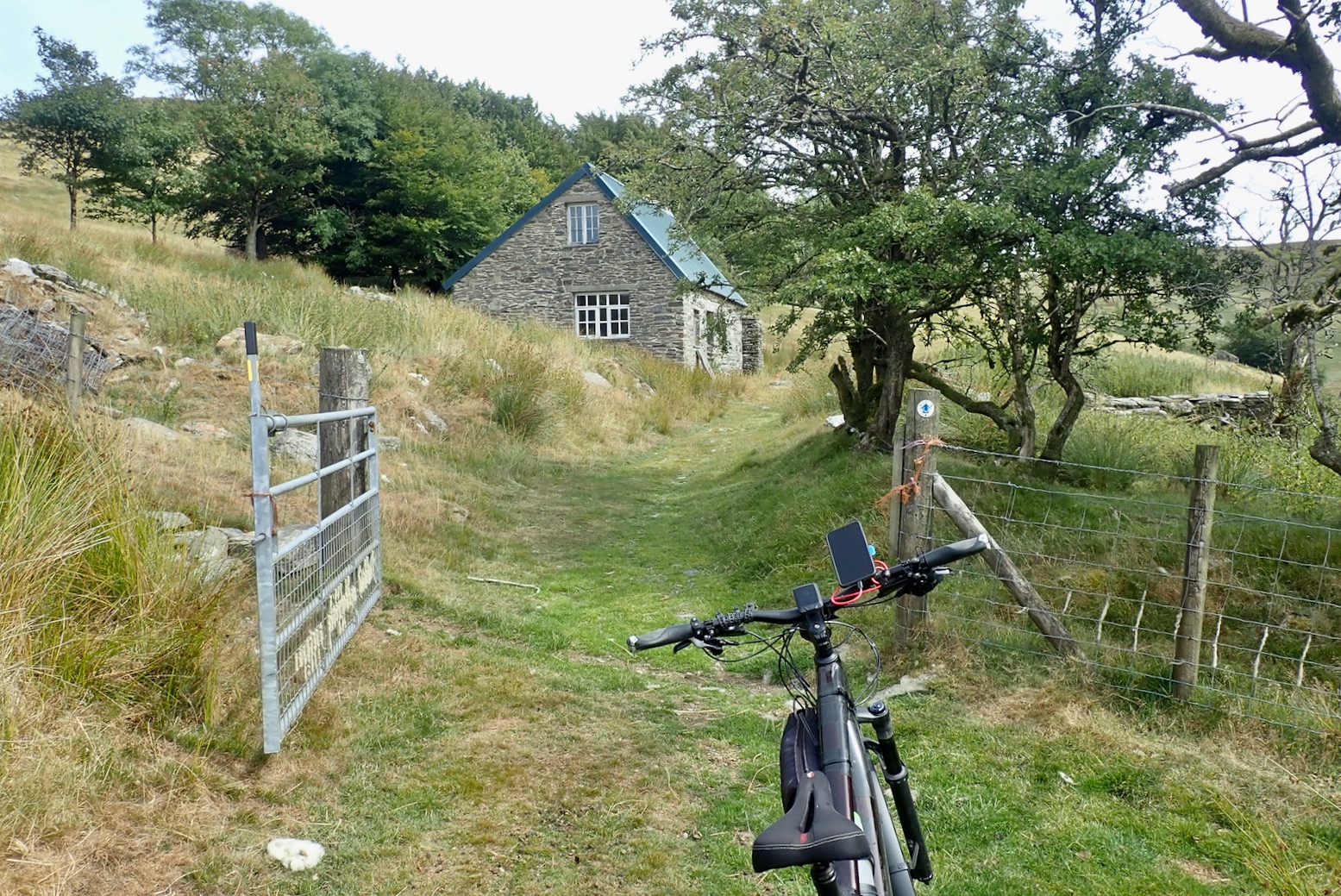
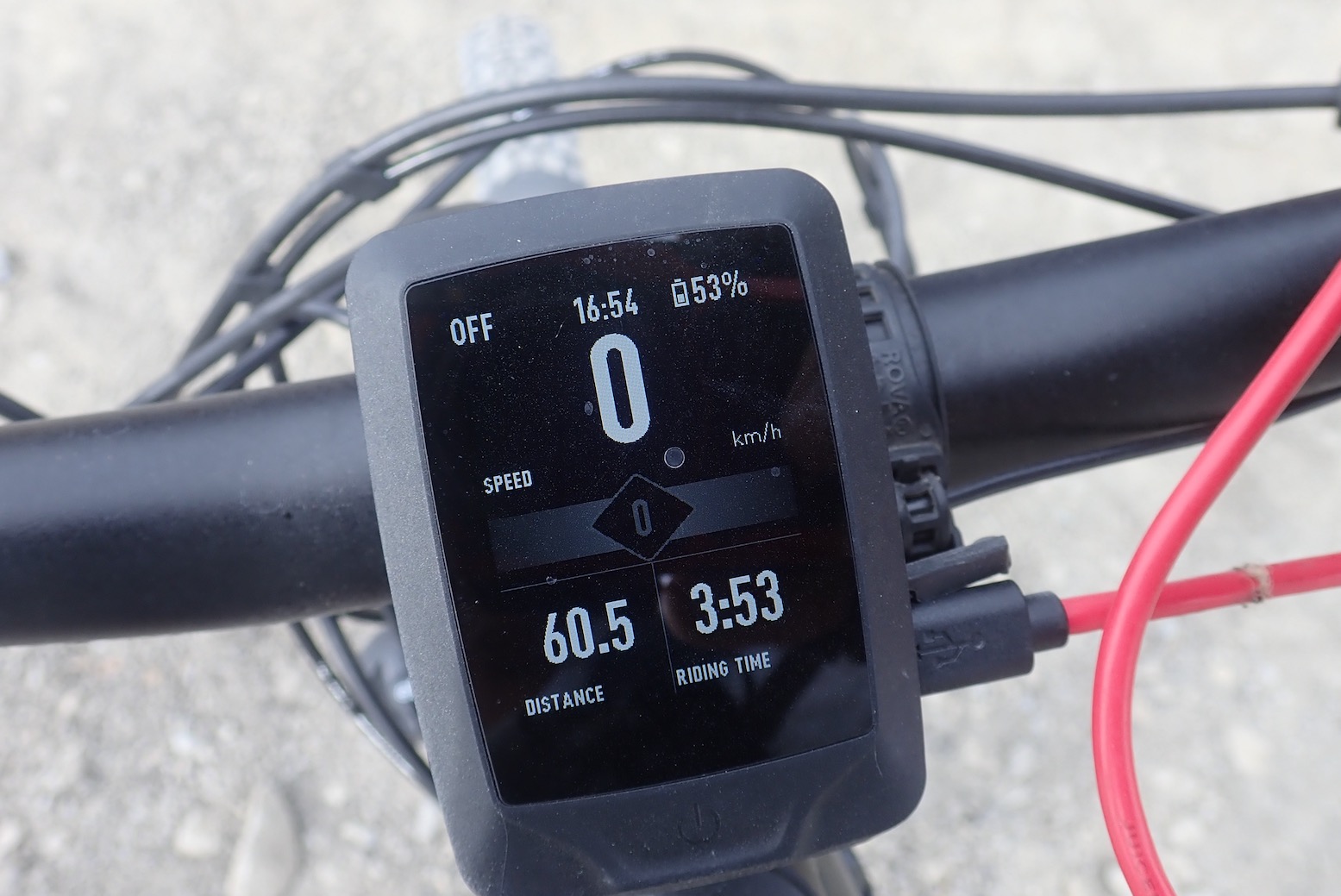
From Strata I nip over Coel Caemadog hill to Ffair-Rhos which eats up a bit of battery and calories. Nice country pub at Ffair-Rhos; the only eating place on the route unless you’re a sheep.I turn off east at the vowel-free vlg of Ysbyty Ystwyth and head for the end of the road along the TCW. But not feeling fully on form today, I shorten the route on the fly to skip 14km via Cwmystwyth.Heading back off-route reconnect with the TCW, initially it was a bit thin and rough towards Pen Rhiwlas hill, so I try to save battery. The water’s already gone.Things ease up as I rejoin the TCW at Pen Rhiwlas, but it still feels bleak as I re-enter the Cambrians. We did the right thing to dodge this stage in June’s wind and rain. There’s no way we or the bikes would have covered the 90kms from Staylittle to Rhayader.I fork onto the wrong track leading out into a peaty wasteland but a check of the OS App sets me right. I really do wonder how we navigated before digital aids like this, specifically gpx tracklogs. I walk the bike down a tussocky hillside to pick up the right way which leads to this semi-derelict house. At the next dwelling (Blaen Marchnant) where the TCW takes a sharp turn south, it’s asphalt all the way past Disgwylfa hill to the Teifi road. That’s a relief. While planning the TCW earlier in the year, I’d flagged this Disgwylfa stage as a possibly challenging section during a long day. When energy (be it watts or calories) is flagging, or conditions turn mean, knowing the state of the track or road ahead really helps with decision making on the day. Maps, even OS, get roads/tracks wrong or are vague, as above: ‘unclassified roads’ from the OS 50k legend. Along with weary MTB-ers, I bet wayward campervanners would also like to know if it’s a tyre-wrecking track or a sealed road. The only answer is close scrutiny of WYSIWYG sat imagery or Open Source Maps (OSM), though, like Google, OSM has little control over user-generated clutter. So no matter how well you plan, it can all still become a bit of an adventure. Fyi, I just did my bit and updated the Blaen Marchnant road on OSM.It’s a lovely hilly ride east along the Teifi road past the Ponds. I decide to check out Claerddu bothy (above) for another time. It’s only mid afternoon but overnighters are already piling in with crates of beer and bundles of firewood to bagsie their spot.It’s a sunny Saturday afternoon in mid-Wales so once back on the reservoir track I’m passed by quads, motos, more quads and fourbies. The west half of this track is a legal byway as far as the Afon Claerwen bridge below the farm (a ‘Ford’ on OS; 52.29006, -3.73242). It doesn’t join up with the Teifi Pools C road, but off-roaders use it anyway and perhaps no one minds. I’ve done many times more off roading in cars and on motos than cycling (mostly abroad), but it’s funny how becoming a MAMIL turns your indignation towards motorised off-roaders ROARING past in their OVER-EQUIPPED machines! Raising some dust myself, my bike picks up a stone that jams in the mudguard. I have the back up to release it. Later on something starts rattling; a loose or broken mudguard stay or battery? I stop twice to check but only when it gets regally bad do I realise the side stand has lost a bolt. Unable to conceive a solid bodge, that’ll be a shame to lose it for the rest of the week..Back at the dam car park I finish the 8-hour day having covered 60 clicks with 1200m of ascent and 4 hours of motor time consuming only 47% of battery. A PB. Could be down to the new tyres.Back at the horsey Mid-Wales bunkhouse. Tomorrow we’re off to join more dots along the Trans Eryri at Cadair Idris.





Leave a Reply