
See also: Wales
This boggy byway won’t be most riders’ cup of tea
Bikepacking Wales guidebook
It was only while having a chat with a rider pushing his flat-tyred MTB back to the Claerwen dam car park, that I realised I’d just traversed the 10-km Monks Trod, a historic and now controversial ancient road built 800 years ago to link the 12th-century Cistercian abbeys of Cwm Hir (Abbeycwmhir), and Strata Florida (see map below). I passed through Abbeycwmhir a couple of times while doing the Glyndwrs Way guide and learned of the 38km abbey link. What most people know as ‘Monks Trod’ is the desolate moorland crossing in the middle of the route, in red below.
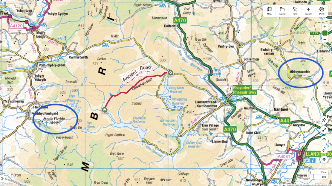
An ancient road, the Monks Trod remains a public highway, classified as a Byway Open to All Traffic (BOAT) along which you can use any motor vehicle and horse-drawn carriage, just like the A44 passing through nearby Rhayader. Of course only 4x4s and trail bikes would attempt it, but as early as 1990 cars were banned outright after mashing the sodden hilltop bogs. Twelve years later trail bikes were banned for similar reasons, and today have regained very limited access, while the lack of fences and gates makes access easy for the few who ride illegally, usually on unlicensed scramblers.

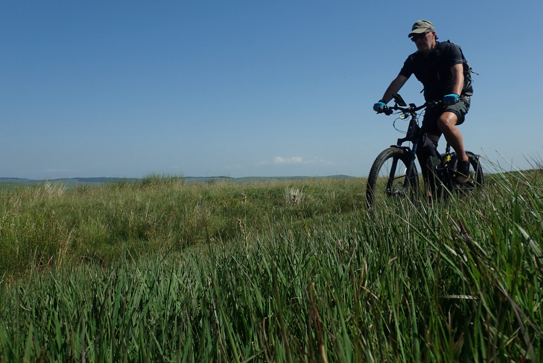
I set off from Pont Elan car park on the newly repaired Tero now functioning on all modes. Technically, I was missing the Trod’s first few hundred metres fording the Afon Elan, and once on the trail struggled to find form on the grassy, rutted track. I’d planned to be here yesterday and do a second day loop today via Strata Florida ruins. But the bike wasn’t ready on time and anyway, with a staggering 32°C in Rhayader yesterday, it would have been too hot to ride.
I wobbled up to the summit of Carn Ricet, arriving at a churned-up peat bog with a white notice fluttering on a stick. I knew what it was before I read it: a TRO or Traffic Regulation Order, probably telling motos to bog off. For me too this was pretty much the end of the riding for the next hour or more, as I pushed the bike from one muddy peat trench to the next.
Some I could hop across, others needed diverting to either side, skipping through marginally less saturated mush while dragging the bike. This I’m sure is partly why Right to Roam was so easy to offer in Scotland: few hikers, let alone MTBs would voluntarily roam across the shin-swallowing, ankle twisting expanse either side of a Highland trail. The benefits in Scotland are largely in the mind – ‘I can if I want to’ – which someone in the film below explains is no small thing, and she’s right. But in Scotland BOATS like the Monks Trod – and therefore motorised off-roading on public byways – does not exist.
There’s a campaign to extend similar rights to England and Wales still suffering the consequences of Norman land dispersal and 18th-century Enclosures when formerly Common land was ceded to rich landowners. We recently watched the Our Land documentary (above) but came out dissatisfied. It failed to get its message across, unlike Nick Hayes’ very enjoyable Book of Trespass (he features in the film). How would it work anyway? What needs changing? Uncultivated open country or moorland like the hills surrounding the Monks Trod have Open Access (light brown on the 25k OS map) similar to Scottish Right to Roam but which excludes cycling off bridleways and byways (as we found in Dartmoor the other week). In Wales that was set to change to a more Scottish access regime following CyclingUK’s Trails for Wales campaign. But as their website says today:
Following years of campaigning by Cycling UK, OpenMTB and other outdoor access groups, in 2019 Welsh Government promised to allow cycling and horse riding on most rights of way, and enable more activities on open access land.… Four years after the announcement, not much has happened. Access is in danger of dropping off the agenda.
The idea of being able to legally cycle on footpaths in lowland England is of course unthinkable. The militant Ramblers would have a fit, and presumably countless kissing gates and styles would need replacing with easy-to-open bridle gates to enable genuine access for all. But the population density of Wales is just a third of England (and Scotland is half of Wales), so you can see why there was something behind the Trails for Wales idea. Powys alone, on whose border the Monks Trod ends, covers a quarter of the country and is one of the least urban and populated parts of Great Britain. Elsewhere, the network of car-free trails in England and Wales feels pretty extensive. Like the two Welsh trails I rode recently (Trans Eryri and Trans Cambrian), it must have been a satisfying challenge to produce a cycle route across the countryside using existing rights of way.


Back to the bogs, this sort of surface is famously crap to walk over even where no off-roaders have churned it up. The once notorious Kinder Scout I first walked in the 1970s is now slabbed (above right). Better for the land, better for users. And let it not be said I did not once contribute to the rotavating of fragile Welsh peatland habitats. In 1981 I well recall doing an enduro (timed off road motorbike event but not a race) 20km north of here on the slopes of Plynlimon Fawr, the highest mountain in mid-Wales. It would be fair to say I got the greater beating and came off the hillside like the Creature from the Black Lagoon, finding just about everyone had packed up and gone home.

There was little recent evidence of motos, but deep tyre ruts maybe years old gouged the sides of natural drainage channels (above left). Rogue scramblers ripping up an ancient monastic byway makes a great headline, and as a result many byways hereabouts have been demoted to bridleways. But for some reason the Monks Trod remains an exception and there’s even talk of building a ‘dry stone causeway’ across the moor, similar to Kinder.
I sat down for a breather and marvelled that for miles in all directions I could see only green rolling hills, not even a wind farm if I chose the right dip, though to be honest any actual drama lay in tackling the track rather than epic vistas. Trench followed trench, and none were rideable, or would consume too much power and chain strain bagatelling through the tussocks.
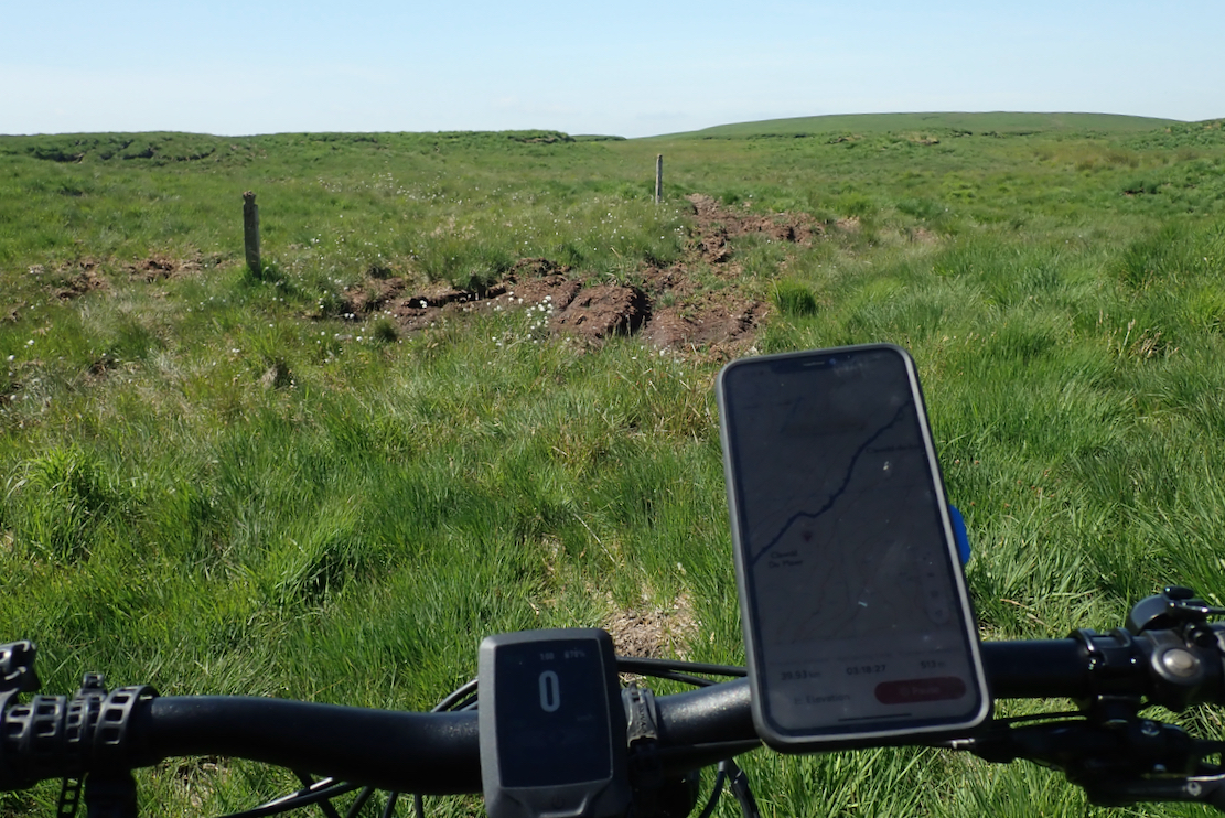
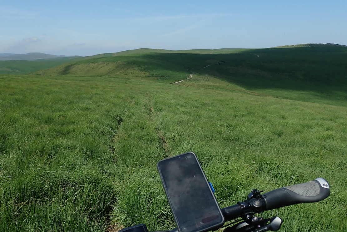
Very occasionally posts marked the way, but without my OS App tracklog, at times I’d have struggled to follow the right track, even in the perfect visibility. The bits in between hid ruts in long grass (above, below) and when the Tero’s pedals hit, the bike lifted and keeled over. Another fun way to tip over was after violently swatting at gruesome cleggs (horse flies) which the hot weather had raised like ghouls from the mires. I tipped slowly like a clown but rolled like a landing para.
After about 6km salvation lay ahead, or so I thought. The white scar of a stony track rose across the hill ahead. At last I could get back on the bike. But once there, a new hurdle rose up to kill the flow: the track was periodically submerged by deep peaty pools – a quick way to ruin an e-bike motor if too deep. Some, like the one below left, had a squelchy way round the side. But below right, had no way round that wouldn’t see me grappling the handlebars while sunk to my knees. Dragging the 28-kilo Tero through that would have been a pain.
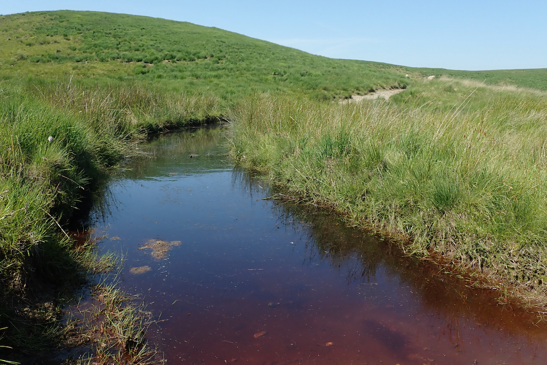
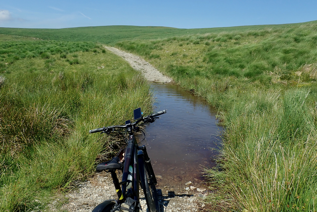
After wading through to verify the pedalled motor would indeed get drowned, the only answer was to grab the Tero around the neck and drag it across the pool like a stubborn calf.

Soon I came across some outcrops – Cerrigllwydion on the map (below), and the 540-m high point on the Monks crossing. I walked up for another breather and even got a signal to call the Mrs and notify her of my amazing achievements. A stiff breeze blew, keeping temperatures down and cleggs at bay.
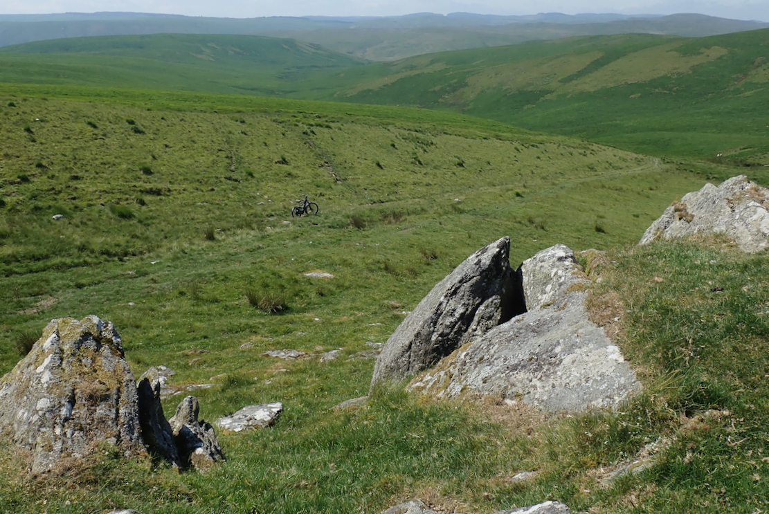
According to the map it was a descent to another peat pool, then up and over one more hill to reach the Claerwen reservoir track. Somewhere around here the Trod took off to the southwest and drops steeply to ford the Afon Claerwen before joining the Claerwen track. Apparently it’s even boggier than what’s gone before.

No watching the phone, I strayed that way then, following another pedal-rut tumble, corrected myself and worked my way east across to the Esgair Clywion track which had been the plan. It was a great decision. Motos carved up the Trod down to the ford to reach the reservoir, slavering themselves in peat muck as they went. This way the track was lovely firm, flat grass, just like I’d hoped. I was able to ride for nearly a mile all the way down to the Claerwen track. Three hours to cover 10 kilometres. A moto mate told me it took as long to ride the Trod years ago. He never came back. I won’t either.


Not in a hurry to return to the car at Pont Elan which would now be as easy as, I carried on west to check the interesting looking Teifi Pools and recce the planned Florida loop for another time. This was much more like it. I’m sure I’ve ridden this Claerwen track before on a moto or an old MTB.

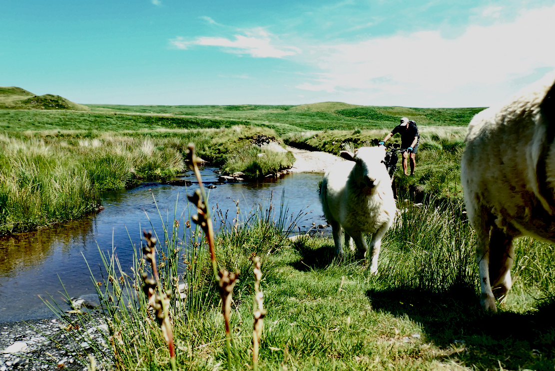
Sheep were having a sip at the Afon Claerddu ford, then photobombed my selfie and messed up the exposure. A kilometre later I met the road from Ffair Rhos where the old asphalt turn off led to Llyn Egnant reservoir and the Teifi Pools. A police car was parked up, skiving or watching out for dirtbag motards? I carried on past the dam, and walked beyond a boggy gate to check the valley round the corner, just 2km from a road and another two to the Florida ruins. One for next time.

That done, I backed up to the lake shore, had some lunch then retraced my route via the sheep ford and rode the Claerwen reservoir track, passing the ancient ‘no cars’ sign where the Trod set off back north to Pont Elan. This was easy and enjoyable riding winding past inlets and over bridges and just one gate.


Near the dam wall I chatted with flat-tyre man who knew the area well and where I picked up some new bike slang: ‘Spesh’ (Specialized; he was a fan too) and ‘bike tart’: a cyclist with a sometimes irrational fondness for the latest tech. He’d split a tubeless tyre and a spare tube had failed to work. This is why I’m happy to stick with tubes. And two of his three current Speshs had developed faulty electronic shifters costing a grand to replace.
I’ve never tried electronic shifters but are mechanical levers (and tubes) so bad, I asked?
‘Oh, they save a bit of wright. I’m just a bike tart!’
But his hardtail Spesh did weigh just 10 kilos.

The rest of the ride followed the riverside road to a succession of dams including the 1904 Garreg Ddu bridge (above) whose green capped intake tower reveals it’s actually a cunningly submerged dam. Although the roads were hardly busy, at this point Bike Route 81 led between the reservoir and the road, crossed it and passed another couple of dams before I met the road back to Pont Elan, which we last rode in the pelting rain a couple of weeks back (and which buggered up my bike’s electrics).

This had been a good day out and it was a shame I couldn’t stay for more. Like my moto mate, I won’t be rushing back to do the Monks Trod – let’s not forget this was at the end of one of the hottest June weeks since in mid-Wales since before the Ice Age, so the Trod was as dry as it gets. But as the 2026 heatwave summer progressed and Wales announced a nationwide drought, it was all about to get a whole lot drier.

Along with a a couple of bothies there are loads more intriguing bridleways and tracks cross crossing the Cambrian hills. Hopefully not all of them are composed of knee-deep mush which now caked the Tero. Time to head back, clean up and plan the next visit.

Leave a Reply