

A few days after our uncompleted Dartmoor ride on the way back from Cornwall, I was back to close the Eylesbarrow Loop taken from the Gravel Rides guidebook (right). That done, I’d follow a self-plotted loop eastwards to fill out the day’s ride. Together they included most of the upland off-road sections of the 43km Dartmoor High Moor Link (below in green) which traversed the moor laterally between Tavistock and Buckfastleigh.

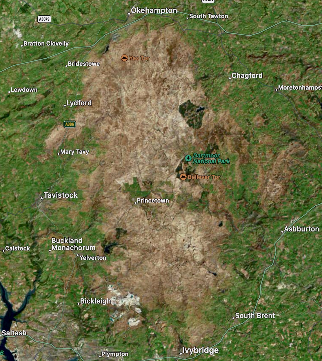
Until you know the place better, the High Moor Link seemed to be the only meaty off-road ride spanning the breadth of moor, but when you think about it, actual upland Dartmoor, as opposed to the national park of that name, is not round but twice as tall (Okehampton to Ivybridge; below right) as it is wide. Due to restricted riding trails (especially in the higher north; below left), I’m pretty sure there isn’t a north-south version of the HM Link that would be permissible on a bike, far less entirely manageable on my heavy e-SUV Tero.

I parked in Princetown, at 435m (1430′) one of England’s highest villages. It’s been a few months so I was looking forward to a cheeky Full English at the Fox Tor Cafe & Bunkhouse recommended in the guidebook, but it was closed and The Old Police Station cafe nearby didn’t look that inviting. So I settled on a snack from the village shop.

Princetown is famous for its Napoleonic-era prison (above on the right) which, after 215 years, closed in 2024 due to excess levels of radon gas. Radon occurs naturally in the granite that underlies the moor but can give you cancer, especially if locked up in an unventilated granite cell 22 hours a day for 22 years. On top of that blow to the town’s workforce, the park’s main Visitors’ Centre also closed last year, all of which helped explain the ease of street parking.
I realise now I ate my brunch right outside the former centre, which had reopened a few weeks earlier as a ‘community-focused enterprise’ called Gather & Moor. Online, it looks like a high-end gift shop/cafe, but at the time the fluttering ‘Gather & Moor’ banners made no sense to me. Clearly the playful phonetic nod to ‘and more….’ passed through my cranium like a jet of radon gas. Unless we’re talking a partnership like Marks & Spencer, grammatically verb+conjunction+noun are a syntaxical air-lock. Perhaps I need to stay in moor.
Anyway, it’s now funded by the Duchy of Cornwall who own all around and the Duke himself popped in the previous week to launch a community fund for the village. Apart from the prison lease (don’t ask), local Duchy rents can be peppercorns, but may not cover maintenance and repairs like normal landlords, which was what did for the government funded Visitors’ Centre.

Fed and watered but without some gift-wrapped Duchy Original souvenirs, I set off south out of town straight onto the open moor with a plan to circle clockwise back to Princetown over about 26km. The guidebook route and the shortened version I was doing today are both extrapolated from two official Dartmoor NP MTB routes: Princetown Railway, 30km and Princetown to Burrator, 20km. For off roading they’re about as long as they get out here.

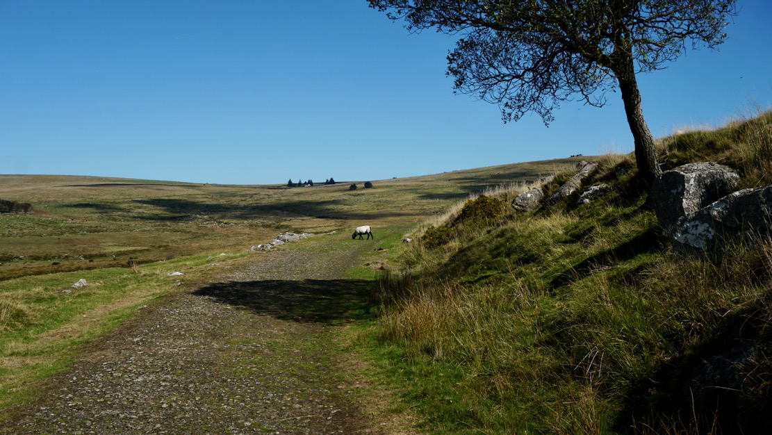
Within a few minutes I’d passed the village dog walkers’ and had the moors to myself. An easy gravel track weaved out onto the peaty wastes, NP images even show motorised wheelchairs trundling along the track. Behind the town a hilltop TV mast was a handy landmark for locating Princetown in the landscape.
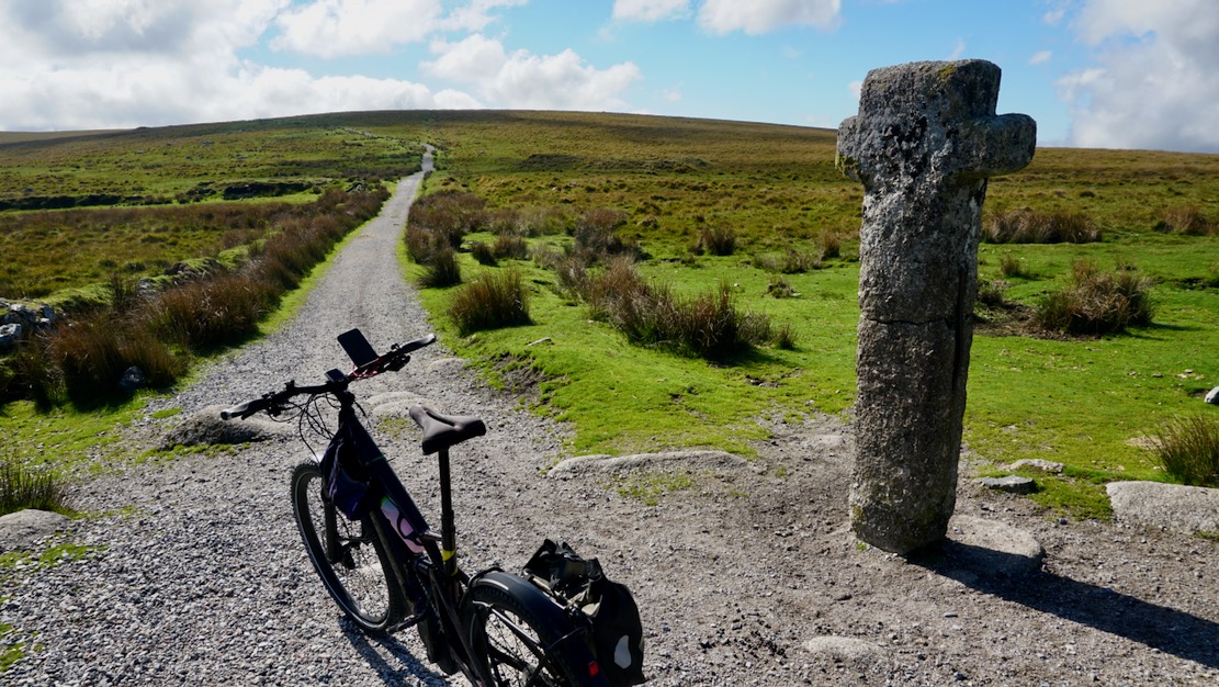
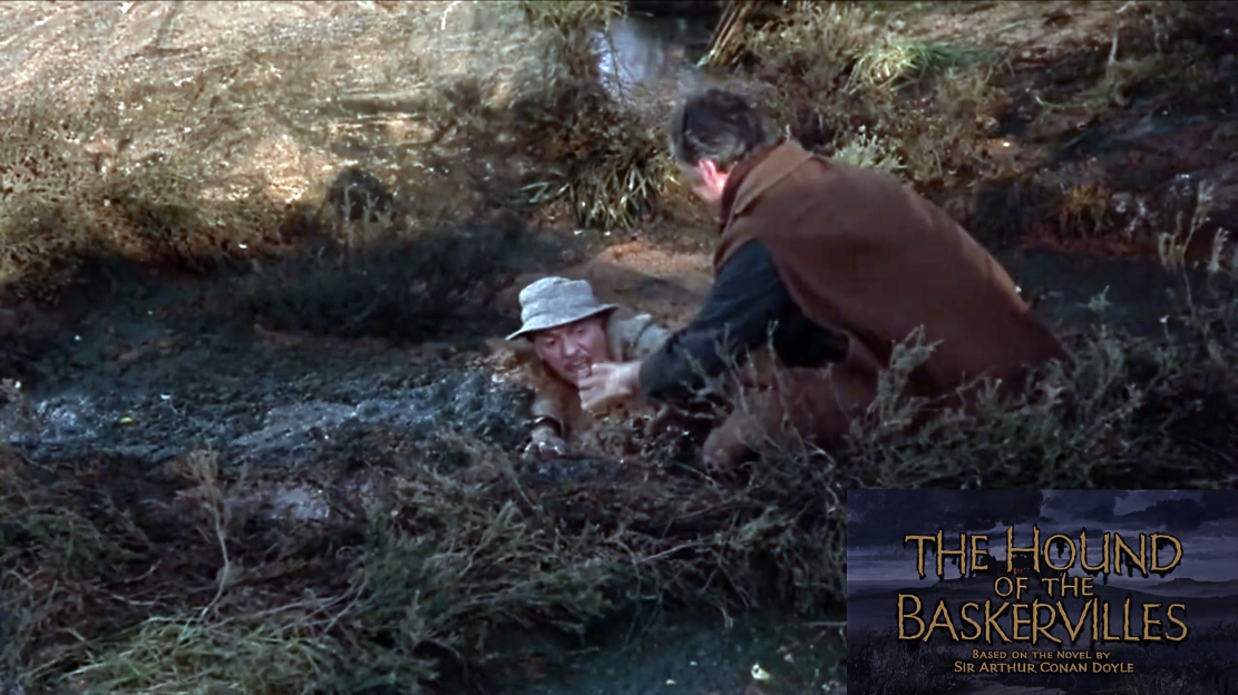
I stopped at Nun’s Cross, a 1000-year old granite boundary marker (above). Just a mile to the east lay the swampy Fox Tor Mires, Conan Doyle’s inspiration for the sinister ‘Grimpen Mire’ bog in The Hound of the Baskervilles (below).

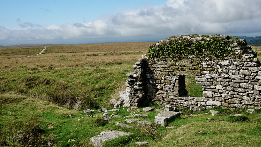
The trail now curved southwest past the ruins of Eylesbarrow tin mine (below), two centuries ago the biggest on Dartmoor. This was the loop’s only rocky stage where a rigid gravel biker must endure a light beating unless they hop off. That soon cleared and only half a hour out of Princetown I was back on a lane near Gutter Tor.
I followed leafy lanes via Sheepstor village and along the east shore of Burrator reservoir, then picked up the railway trail we did last week, looping up and around Kings Tor all the way back into Princetown. With the steady grade, old railway bridges and views off to the moor’s verdant fringes, this remained the best part of this loop and a couple of other bikers were out enjoying it too. All up, the whole thing is an easy and enjoyable loop anyone could manage with two hours to spare.
High Moor Link
Back in Princetown I succumbed to the lure of a closing-down sale at the Basecamp outdoor shop. But the sad truth was I didn’t need any more gear while the discounts had not yet reached sufficient levels to warp that fact. Instead I chatted with the owner about Dartmoor mountain rescue call-outs off the scale (as in Snowdonia), the idea of alpine-style insurance and the relatively limited MTB-ing here when compared to the giddyingly genuine Right to Roam in the Highlands where she was moving to.
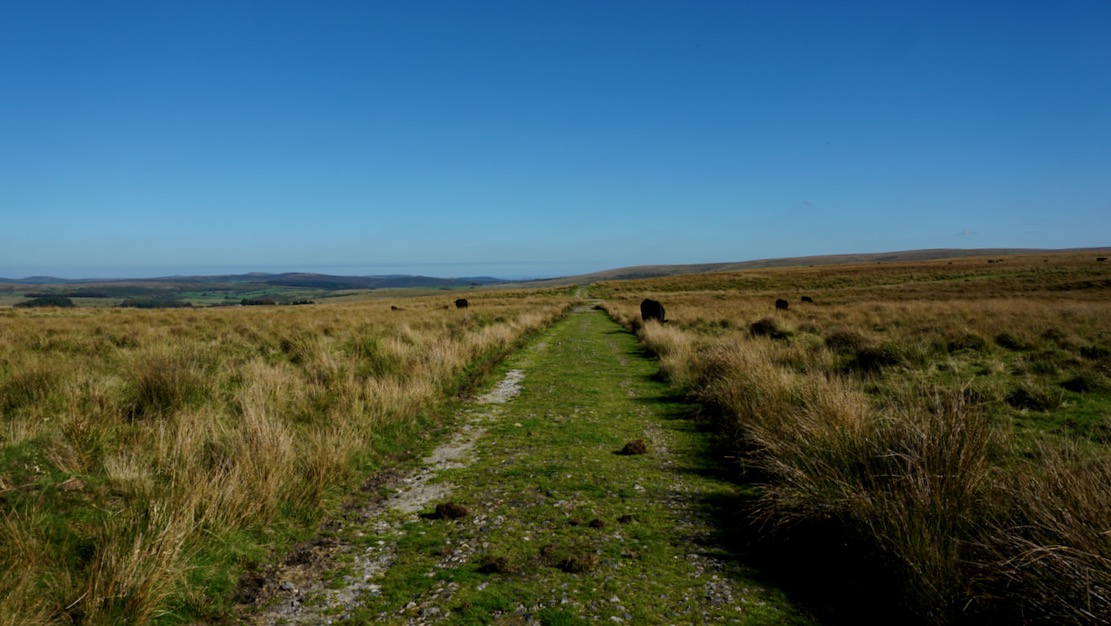
East of Princetown I’d strung together a 20km loop of bridleways and lanes using OS maps, continuing along the High Moor Link, then back via Bellever Tor and Two Bridges. Out of town was the usual hurdle of gates until back out on the moor where ponies, cows and sheep grazed in perfect harmony. There was no wheelchair-friendly gravel track here, just a broad grassy trail (below) with regular muddy cross ditches which reminded me of pushing along the Monks Trod in Wales, but with embedded rocks. The morning’s route had been a little under-challenging; here you had to focus on the trail, especially on an e-bike where clouting the motor casing could end badly.
The trail left Open Access land into farm country hemmed by dry stone walls and crumbling ruins.

At the junction below I followed the sign right which soon led over tottering boulders and dense gorse thickets where lifting and pushing the bike became extremely awkward whereupon it entered a stream pungent with dissolved radon.

Up ahead I could see the wooden footbridge (‘FB’, above) I needed to cross – and that I was offline to get there. I’ve learned this summer that not all bridleways are ‘ridle-ways’ but here they couldn’t be serious, could they? I managed to squeeze out of the noxious stream onto a small field via another collapsed wall overgrown with nasty gorse which this year, along with brambles has become my least loved shrub.
I walked back see where I’d gone wrong. Maybe the signpost on the right above was misaligned? A trail did lead off that way but if you want to reach the bridge without getting lacerated while spraining both ankles, lift the bike over the arrowed boulders pictured above left, and cross the field to the bridge like a normal person. You’re just 10-15m north of the bridleway as shown on all maps, but like a cliff edge, 10m makes all the difference. There’ll be another collapsed wall to ease the bike over right by the bridge spanning the Swincombe river.
Once on the far side I followed an old asphalt lane via Hexworthy to the B3357 Two Bridges road. I turned off northwest for ‘Huccaby Moor’, aiming for a suspiciously straight bridleway on the map that swiped across the hills like a telegraph line towards Bellever. From there I could work my way to the B3212 for Two Bridges and Princetown.
Heading up, the hill became thick with heather and the track narrowed to a contorted 10-inch wide run-off channel dotted with rocks and small steps. I’d ridden similar terrain on Purbeck the day before, but even with e-assistance found the heavy Tero exhausting to ride. The trail opened up near Huccaby Tor, but after an ancient gate it was more of the same, front wheel wobbling and pedals clouting the channel’s edges while barely maintaining balancing pace.

By 4.30 I’d done about a mile after huge amounts of effort to follow the least unrideable terrain. Admitting this might not let up before my radon exposure levels hit critical, I decided to turn back and blast the sunlit road back to Princetown.
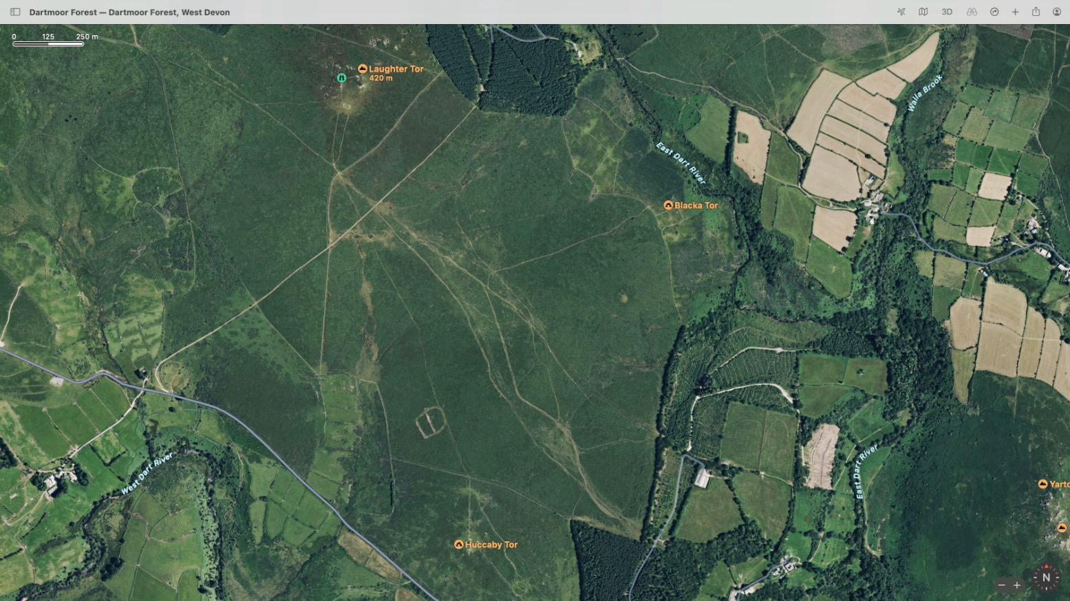
What I should have done is what I’d always do abroad when researching new moto trails: check against satellite imagery (above, usually ESRI, ie: not Google). Maps are just graphic interpretations but with satellite WYS is WYG. I’m slowly learning that a bridleway marked on an OS map is just a depiction of a right of way. It may not be any more navigable than the Grimpen Mire. Better research needed for future Dartmoor rides away from the obvious routes.
That little excursion finished me off and I got back to the van a dripping wreck. I lashed the bike down, opened the windows and headed home.

Leave a Reply